Finally drying out today!
A transitional day of weather is on tap as New England shakes off the raw and damp conditions in favor of several dry and seasonable days. High pressure centered over eastern Canada gradually pushes down into New England today. After a few remaining sprinkles or light showers in southern RI this morning, drier air will be pushing into the region and gradually break the clouds allowing some sunshine to show up later this afternoon.
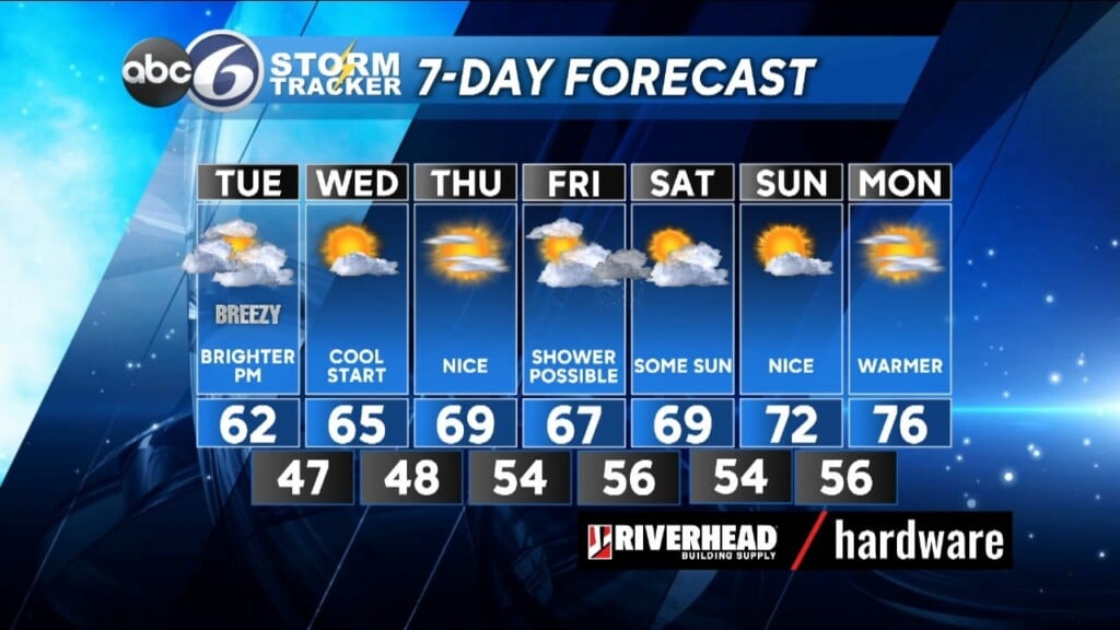
The sky will continue to clear overnight and lows will fall to the cool mid and upper 40s throughout RI. The aforementioned high remains over the region for Wednesday and Thursday giving us mostly clear skies paired with mild days and cool nights through this stretch. Winds also look to remain on the light side. This should be an excellent opportunity for comfortable outdoor work.
For the longer term the high takes a 1-day vacation on Friday before returning over the weekend. This can allow some showers to occur on Friday from the low pressure system (formally known as Ophelia) moving back in our direction, but it’s still a bit too early to pinpoint how far north this shower threat will get. Dry weather returns over the weekend with a warming trend as we head back into the 70s!
ABC6 Meteorologist Bill Gile