A warming trend on the way!
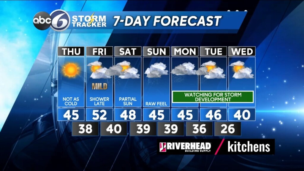
It’ll be another cold night tonight with temperatures dropping into the 20s regionwide as the sky will be mainly clear. As High pressure moves off the mid-Atlantic coast tomorrow look for bright sunshine and a light southwesterly breeze that will send our high for the day climbing back to normal levels, reaching around 46°. It should stay dry throughout most of Friday and even milder still with highs in the low 50s, but clouds will quickly take over in the morning as a storm system approaches for later in the day. Rain should begin to move in by nightfall and will exit the region by early Saturday morning.
As we move through the weekend and into early next week the weather pattern is going to be quite active and we will be watching several waves of Low pressure approach and move past New England into early next week. The problem is that right now its just way too soon to have a high level of confidence as to where the storm centers will track or how close they will be to us.
Saturday should stay dry with even a few breaks of sun and highs in the upper 40’s. Sunday will be cloudy and perhaps feeling rather raw with a threat of or a shower or two and highs in the mid 40s. Beyond that, Long range model guidance is conflicting as to what a potential offshore storm development will do for Monday and Tuesday so we really need to give it another couple of days to see if things can come into better consensus. Right now, it does look like there will be some rain at least for Monday and perhaps a wintry mix or snow for central and northern New England.
ABC6 Meteorologist Bill Gile


