A Warming Trend Into The Weekend…
Temperatures through the overnight won’t be as cold as last night with lows only dropping back to around 40°. There will be a few passing clouds from time to time, but otherwise expect mainly clear conditions which is good news because there may be an opportunity to the see Northern Lights in the sky tonight!
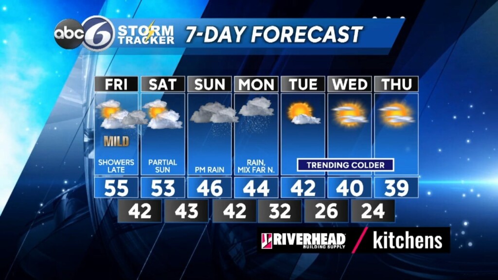
Tomorrow we’ll start out with sunshine, but clouds will quickly fill in by noon and then a light shower will develop around 3pm. Temperatures will be on the mild side, mid-50s. Then, a larger area of rain moves through during the evening and should be done by Midnight.
The weekend starts out dry with a lot of clouds around, but there will also be partial sunshine filtered through the clouds with highs holding in the low 50s. Clouds will dominate the sky Saturday night and there could even be a shower around. For the balance of the weekend we’ll be keeping an eye on another storm coming up from the southwest. This will bring rain Sunday afternoon that will last into Monday and we’ll start to cool back into the 40s as winds turn out of the Northeast.
When the storm pulls away Monday night it will start turning even colder for Tuesday and that colder trend will continue into the midweek stretch as sunshine returns.
ABC6 Meteorologist Bill Gile


