Rain On The Way Later Tomorrow
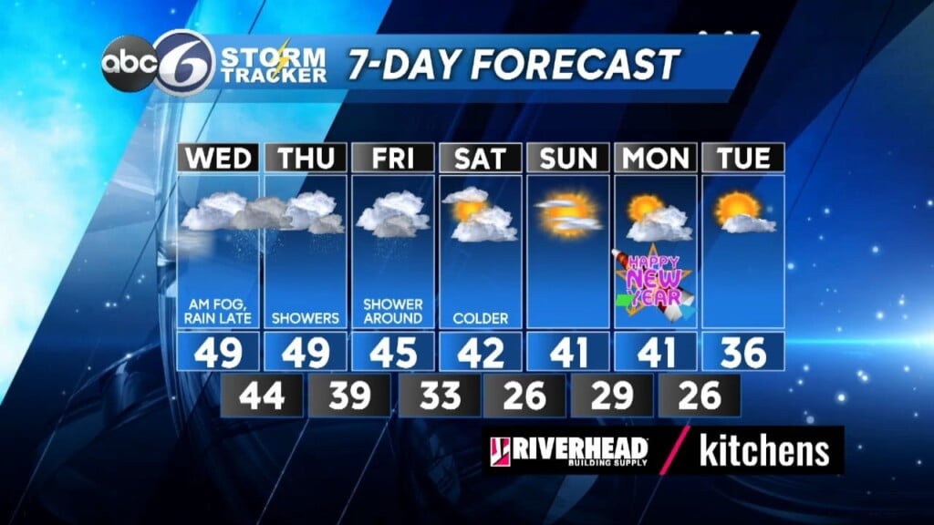
Areas of locally dense fog, meaning visibility 1/4 mile or less, has been developing this evening and will continue throughout the night as temperatures hold fairly steady only dropping back to around 40°. We’ll still be dealing with lower visibility in the fog tomorrow morning as an area of low pressure moves up from the Carolinas tomorrow.
Much of the day will just be cloudy and rain-free until the late afternoon, especially after 4 PM. Look for highs to reach the upper 40s. Periods of rain will continue through the overnight tomorrow night and will become moderate to heavy at times while most of us are sleeping. Fortunately, this looks to be a rather fast moving system so rain totals look to generally be between 0.75” to 1.25” of rainfall and this should not restart any flooding of rivers or streams. Another bit of good news is that this will not be a high wind event either.
The bad news is that Low pressure is slated to linger between the Gulf of Maine and Nova Scotia from Thursday afternoon into Saturday, so pockets of drizzle and occasional light rain showers will persist through Friday. High Thursday will remain in the upper 40s then cool to the mid 40s Friday. It will turn colder (but actually back to normal) for the weekend, last days of 2023 and the start of the New Year as the sunshine returns!
ABC6 Meteorologist Bill Gile


