Finally emerging from the Arctic chill!
Another frigid night is at hand tonight under a clear moonlit sky and easing winds. We’ll have lows drop to the lower teens and when the breeze is factored in it will feel like it is in the single digits as you head off to work or the bus stop tomorrow morning. High pressure will be working off the mid-Atlantic coast over the next couple of days and that means we’ll be seeing a warming trend that actually gives us a January thaw this week!
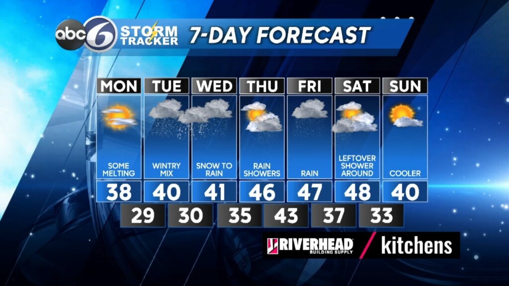
Sunshine will be with us throughout the day, although some mid-level clouds will begin to filter the sun just a bit for the afternoon as highs climb into the upper 30s which finally gets us back to normal and starts the melting process. By Tuesday afternoon we’ll see some light snow or a wintry mix developing across the region that will endure into Tuesday night/early Wednesday. At this point in time it looks like we could see 1-3 inches of snowfall across RI before everyone starts to change over to rain with highs reaching around 40°.
The second half of the week will remain unsettled, meaning more rain Thursday and Friday as temperatures climb into the upper 40s! There may be a left over shower around for Saturday, but otherwise we should be drying out and cooling back to 40 by Sunday.
ABC6 Meteorologist Bill Gile


