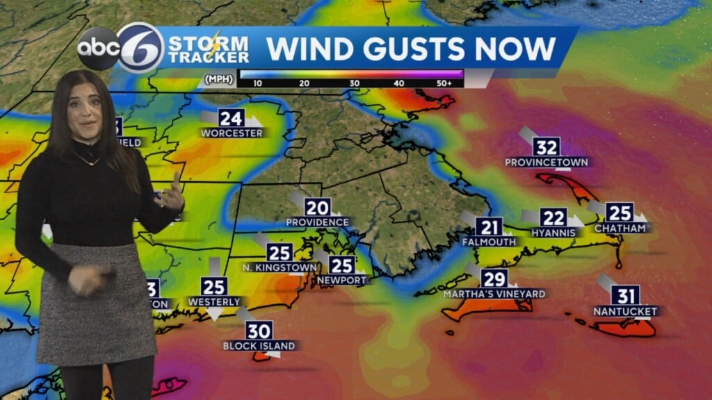
Blustery Start to the Week
Sunday evening we have a slight chance of a brief shower as a weak front comes through. Otherwise, look for mostly cloudy skies overnight and cold lows dropping into the lower-30s. Monday kicks off the workweek with some early cloudiness, but we will clear to a mix of sun and clouds. Monday will become quite windy and a WIND ADVISORY has been issued from 8am Monday through 1am Tuesday. During the advisory tine, we have the potential of gusts up to 50 mph and there is a chance of power outages. Temperatures will be seasonable Monday, topping out in the mid-40s. Area rivers are still higher than flood stage and Flood Warnings are still in place for the Pawcatuck River in Westerly and at Wood River Junction, the Pawcatuck River in Cranston and the Wood River in Hope Valley. The latter two are expected to be above flood stage into Tuesday. Tuesday will have an abundance of sunshine and milder highs in the mid-50s. Wednesday and Thursday will also have sunshine and temperatures in the upper-50s and lower-60s. Unsettled weather comes in Friday through the weekend with a chance of showers.