Chilly, Wet, and Raw Days Ahead
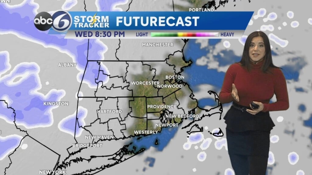
Call Wednesday the calm before the storm as we are looking cloudy with chilly temperatures topping out in the mid-50s. Overnight tonight we have a chance of showers and steady rain will be in place for the morning. Rain will be locally heavy at times as a nor’easter comes through the area. This nor’easter will have many facets from heavy rain to a chance of thunderstorms, winds gusting greater than 30 mph, coastal flooding and localized street flooding. Thursday will be chilly and raw as temperatures will be in the lower-50s, nearly 20 degrees colder than average. Friday will be mostly cloudy with a chance of showers and early patches of fog. Friday highs top near 60. The holiday weekend kicks off with a mix of sun and clouds Saturday, a slight chance of showers and highs near 60. Sunday looks mostly sunny with highs near 65 and Memorial Day Monday will be the best day of the holiday weekend with sunshine and highs in the lower-70s.