Showers & Storms Expected for Sunday
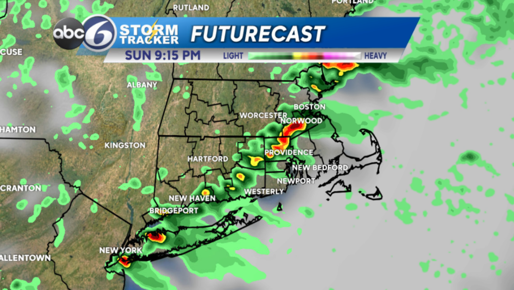
We’re in Stormtracker Alert mode today as two rounds of showers and storms are expected in Southern New England.

The first round will hug the coast this morning, leaving the greatest storm potential for the South Coast. What we do see from this round will largely bring heavy rain, thunder & lightning, but we could have some gusty winds as well.


We’ll catch a break in the middle of the day, with a mix of clouds and sun, highs in the low 80s and a muggier feel. However, the second round of storms moves in with a cold front this evening. That round could also have heavy rain, gusty winds, and even some small hail as well for Rhode Island and Southeastern Massachusetts.


Make sure you’re staying weather aware and have ways to get Watches & Warnings! Today is not the day to get caught out in a storm!
Low pressure leaves us late tonight/early Monday morning, opening the door for an overall nice Monday. Clouds will decrease, leaving us with sunshine and temperatures in the upper 70s/low 80s. We’ll be less muggy as well. Tuesday is nearly identical, but temperatures will be a degree or two cooler in the afternoon.
Wednesday stays comfortable and mostly sunny, with highs in the low 80s. Thursday begins a warmer, muggier trend with highs in the mid 80s. Friday could reach the upper 80s, with a few showers and a thunderstorm possible later in the day.
— Kristina