Near Blizzard conditions possible Saturday
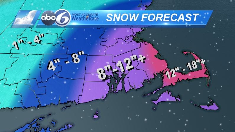
WINTER STORM WARNING for majority of the area until 1AM, A BLIZZARD WARNING for eastern Plymouth County, the Cape/Islands until 3AM. Snow will continue to be moderate to heavy through the afternoon and evening, reducing visibility and creating dangerous driving conditions. On top of the heavy snowfall, winds will be gusting 25-35MPH with 35-45MPH wind gusts possible for SE MA. This causing blowing and drifting snow and also creates near white-out conditions. Snow tapers for Rhode Island late this evening (10-11PM) but ocean enhanced snow may linger for far SE MA overnight. Much of the area will see 8-12" with higher totals expected for far S/E MA.
Overnight temperatures will drop into the teens so anything untreated will be very icy. Sunday looks partly cloudy and still windy with gusts 20-25MPH. Highs will only make it into the low to mid 20s and it will feel even cooler. A few isolated snow squalls will be possible Sunday afternoon.
We have one more frigid day Monday with highs only in the 20s. After that, we start to warm a bit and will see some decent melting through much of next week.