A very warm, but comfortable summer day
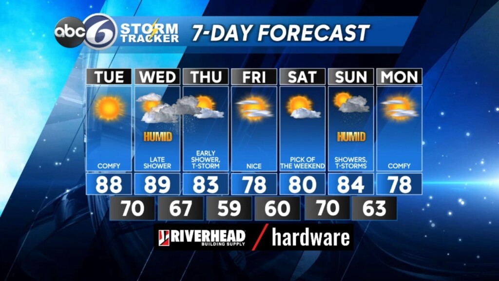
One of the nicest days of the week is coming for your Tuesday as High Pressure finally wins out over persistent Low Pressure. Expect a lot of sunshine with only some wispy clouds crisscrossing the sky by the afternoon. Temperatures become very warm to basically hot in the upper 80s to near 90, but rather comfortable with dewpoints holding in the 50s.
Muggy conditions return and temperatures remain hot on Wednesday, giving the feeling of a more oppressive summer day. A late day shower may pop up in one or two spots, but otherwise it will essentially remain a dry day. However, cold front will move through New England late Wednesday night and Thursday morning producing a few thunderstorms. Any of these storms can certainly produce flooding downpours and perhaps damaging wind gusts.
The last of the showers will be exiting the east coast by mid morning Thursday then gradual clearing gets underway as High Pressure builds east from the Great Lakes. The High delivers the other nice day of this week on Friday when sunshine pairs with very comfortable temperatures and low humidity. Fair weather looks to continue into the start of the weekend, but eventually, Low Pressure introduces showers and thunderstorms again on Sunday.


