Unsettled and cooler for the midweek stretch
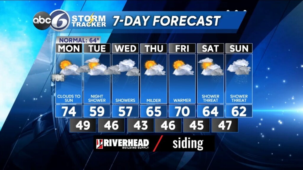
After a beautiful Spring day today with highs in the mid 70s things are going to be changing as we head into tomorrow and Wednesday as the weather pattern turns a bit unsettled meaning there’ll be a lot of clouds and a few passing light showers. Fortunately, rain totals through the next couple of days won’t amount to much, generally 0.1-0.2 inch of rainfall.
Clouds return this evening and a light rain shower or two will develop after Midnight. Lows will drop back to around 50°. Tomorrow will bring clouds a another passing light shower or tow for the morning and then remain mainly cloudy for the afternoon, but winds will be out of the Southeast everywhere and that means much cooler temperatures with highs only in the upper 50s.
A similar situation plays out again for tomorrow night with a few showers overnight and Wednesday morning then lingering cloudiness for the rest of the day with highs again in the mid and upper 50s as a weak wave of Low pressure slides out to sea south of New England. Once that system is gone though, we’ll get back to some sunshine for Thursday and Friday and that will take our temperatures back into the 65-70° range!
Looking ahead into the weekend things will become somewhat unsettled again with more clouds and a shower threat for the region, but I’m not talking about washouts by any means, just scattered light showers possible at this point.
ABC6 Meteorologist Bill Gile