Both sunshine and winter return on Thursday
But the cold stuff won't last too long...
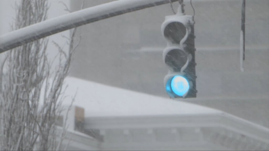
A sharp cold front moved through the area late Wednesday Night and will soon be gone, but it brought heavy rain and gusty winds to the area – the latter leading to spotty power outages.
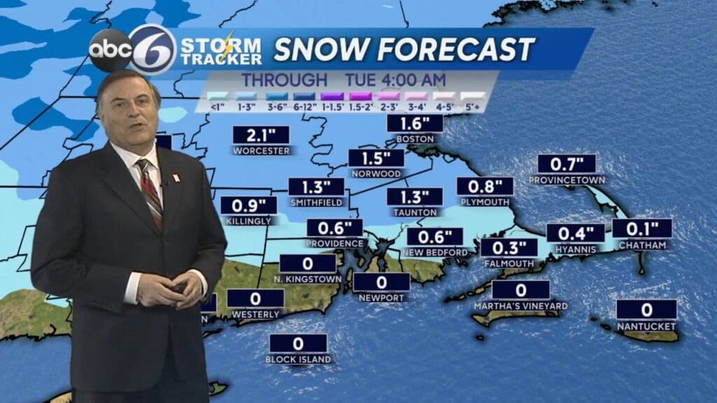
Heavy rain is changing to a burst of snow as temperatures drop rapidly behind the cold front. No accumulation is expected but we could see a quick freeze of wet and untreated surfaces.
Sunshine returns for Thursday, but temperatures will be cold – highs in the 30s will feel more like the 10s or 20s with blustery conditions.
Friday will be better as winds will subside Thursday night. Highs will be in the mid 40s by the afternoon.
The 50s return just in time for the upcoming weekend, but there will be a chance of showers both days.
Right now Saturday looks slightly weather, with a drier trend later in the day on Sunday. Expect this forecast to be tweaked a bit more.
STAY WITH ABC6 FOR THE LATEST WEATHER UPDATES!