Cold and wind continue, tracking light snow for Saturday
Our frigid week continues for one more day before things improve a bit. But right now, it is brutal out there!
Wind chills are in the single-digits, making for yet another bitter start tomorrow morning.
Winds will continue to gust around 40MPH throughout the day, under a mix of sun and clouds. There could be an isolated snow shower out there.
Winds will start to relax a bit into Friday, and temperatures will finally pull above freezing. Clouds will then increase Friday night ahead of some light snow on Saturday.
Models are in good agreement that the southern storm will fail to phase with a northern clipper in time. They do eventually, but out over the ocean Saturday night into Sunday.
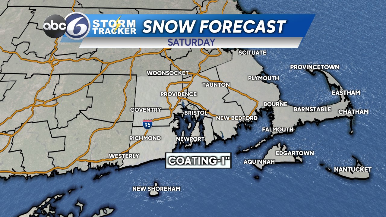
We could see around an inch of snow in spots, so watch for some slick travel. Temperatures remain in the upper 30s with a bright and breezy day Sunday.


