Cold snap Wednesday paves the way for snow Thursday
Winter haters, rejoice! This afternoon we reached the halfway mark for winter.
After a mild start to the day, temperatures are falling and it has turned windy out there.
The wind will start to lighten up after midnight, but it will be frigid into Wednesday morning with temperatures between 15-20°, and wind chills even a few ticks colder.
Expect plenty of sunshine tomorrow, but it won’t help much with temperatures around 30°. The cold air sticks around into Thursday morning as our next system arrives.
A wet snow will begin around sunrise Thursday morning before eventually changing over to sleet/rain from south to north.
Providence and points south will likely have changed over before noon, while northern spots could remain snow a bit longer.
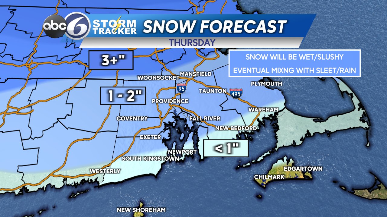
The precip will begin to taper off by 2-3pm. Because of how fast the storm is moving, our accumulation will be limited and both commutes may wind up being okay.
Friday and Saturday will be quiet, and then a very similar storm plays out Saturday night into Sunday morning. Stay tuned for more on that as we draw later in the week.
-Geoff


