Cooler temperatures moving into the area
A few flurries possible
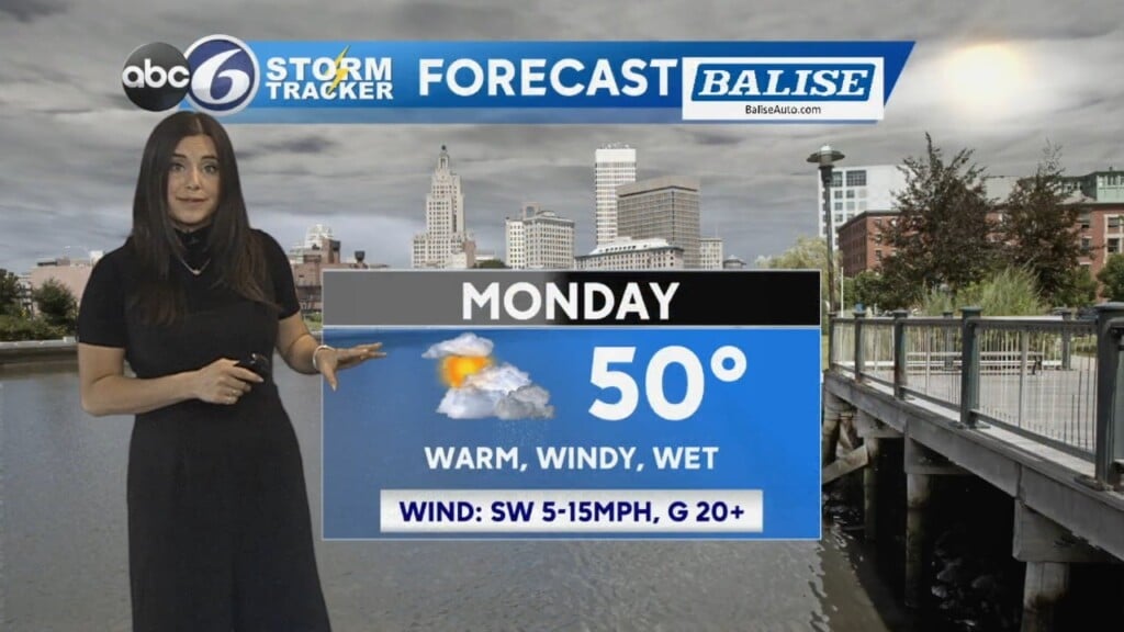
One more day with temperatures running slightly warmer than average with highs in the low 40s. Today will start with sunshine but some clouds will roll through the area this afternoon. Another chance of a few sprinkles or flurries possible, but overall things stay dry. Tonight will be partly clear and cool with lows in the mid to upper 20s.
Wednesday will be a cooler day with morning temperatures in the 20s and afternoon highs in the mid to upper 30s, exactly where they should be for this time of year. We’ve seen above average temperatures every day so far this month but that pattern looks to be breaking into the upcoming forecast. Mostly cloudy Wednesday with a few flurries possible at times. Thursday morning is chilly with temperatures in the teens and low 20s. Expect a mix of sun and clouds with highs in the mid to upper 30s. A few flurries possible once again, especially late in the day.
Friday will be a few degrees warmer with morning temperatures in the mid to upper 20s and afternoon highs in the low to mid 40s. Expect a mix of sun and clouds.
Temperatures drop again into the weekend with morning temperatures Saturday in the 20s and afternoon highs in the mid 30s. Mostly cloudy and a bit breezy. Sunday starts in the teens with afternoon highs only in the low 30s. Plus, it’ll be breezy so we feel even cooler. A mainly sunny day expected.
Cooler temperatures look to stick around into next week.
Chelsea Priest, ABC6 Meteorologist
cpriest@abc6.com