Delightfully warm this week!
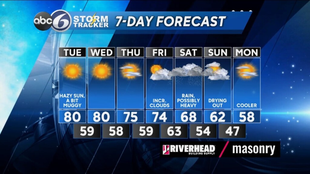
High pressure will be in control of the Northeast region throughout the entire week. That means we can expect a good deal of sunshine and warmer than normal temperatures. In fact, for Tuesday we will be encroaching record highs with a light westerly breeze, although we may fall just shy in Providence but New Bedford could reach it.
TUESDAY RECORDS
Providence — 83 (1922)
New Bedford — 79 (2013)
By Wednesday, the high pressure system will shift offshore and that will create an onshore breeze so reaching the record then will be a lot more challenging, plus the records are actually a few degrees higher than they are for tomorrow. Mid-70 degree temperatures will be more common throughout the region for Thursday and Friday. Clouds will be on the increase Friday as our next weather maker approaches. Unfortunately, right now it looks like rain will develop Friday night and continue through the day Saturday, possibly heavy at times. As we finish up the weekend Sunday we will be trying to dry things out but I would still expect to see plenty of remaining clouds and then it starts to turn cooler heading into next week.
ABC6 Meteorologist Bill Gile


