Gearing Up For A Wet & Windy Thursday
The countdown is on until this late season Nor’Easter arrives here in Southern New England. For the time being, expect mist, drizzle and a shower or two this evening and overnight. Temperatures will fall to the mid 40s.
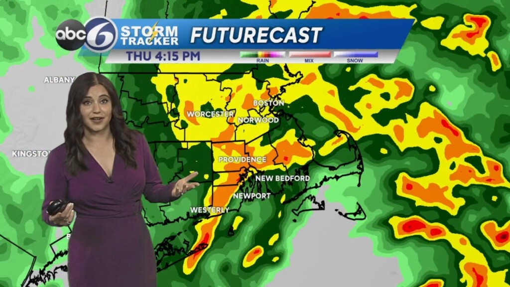
The heavy stuff begins early tomorrow morning, and will make the morning commute slow and soggy. Expect some ponding on the roads, and expect traffic to be slower than normal. We’ll continue to see rounds of rain throughout the day. Right now it looks like the heaviest rain will fall between around noon and the early evening. A rumble of thunder isn’t out of the question with this storm either, though it is not the most likely concern with this storm.
In the late morning through the rest of the day, the wind will kick up as well. We could see gusts of 35+mph here at home. The North & South Shores could see gusts up to 50mph and the Cape and Islands could see up to 55mph.
We’re also keeping an eye on the potential of some localized street flooding and minor coastal flooding as we get near high tide on Thursday afternoon. Make sure that if you have to get on the roads tomorrow that you are not driving over any flooded roadways! “Turn around, don’t drown,” as the saying goes.
This storm moves on to the north late Thursday night and Friday morning, leaving us with a few leftover showers and clouds. Highs will be in the mid to upper 50s. Saturday becomes partly sunny, though a stray shower or two could stick around. Highs will climb a touch into the upper 50s and low 60s.
Sunday continues to improve, with a partly sunny sky and temperatures in the low to mid 60s. But the nicest day of all looks like Memorial Day itself– Monday will be mostly sunny with highs in the low 70s!