Heavy rain and storms Tuesday morning
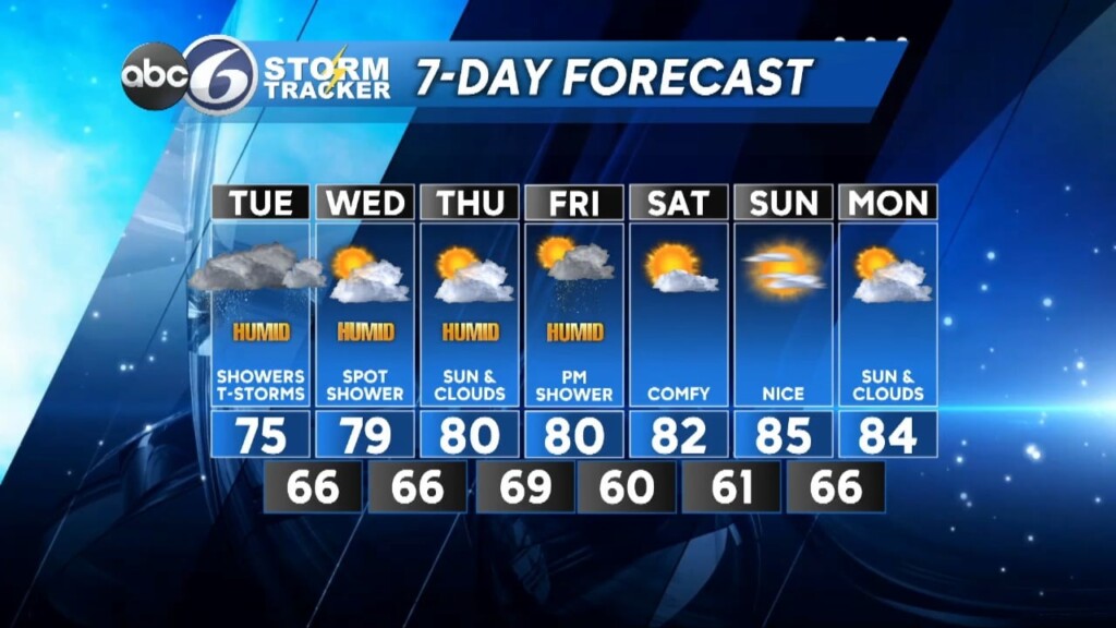
Clouds will be with us overnight as a a couple waves of low pressure head toward southern New England from the Ohio valley. We’ll be keeping a close eye on a warm frontal boundary Tuesday morning. If that front can lift to the north of RI we will run a greater risk of seeing some strong to potentially severe thunderstorms, mainly between 5-10 AM. Any of these storms would be capable of bringing torrential downpours that can cause localized flash street flooding and damaging wind gusts. There is also a very low possibility of tornadic or waterspout spin ups, so be weather aware for any warning alerts throughout the morning.


Once that wave goes by clouds will prevail for the afternoon and then another round of showers and possible thunderstorms will develop during the late evening hours as a second wave of energy moves through. Rain totals look to be on the order of 1-2 inches (isolated 3 inches) in southern RI and southeast MA with lower amounts to the north.

High pressure then builds in for the midweek stretch bringing a mixture of sun and clouds and very muggy conditions. The next threat for showers and storms arrives Friday afternoon and once that goes by it looks like we are in for a nice comfortable weekend with a good deal of sunshine.
ABC Meteorologist Bill Gile


