Messy mix on tap for Thursday
As we head into the second half of winter, our chances for snow are trending upward.
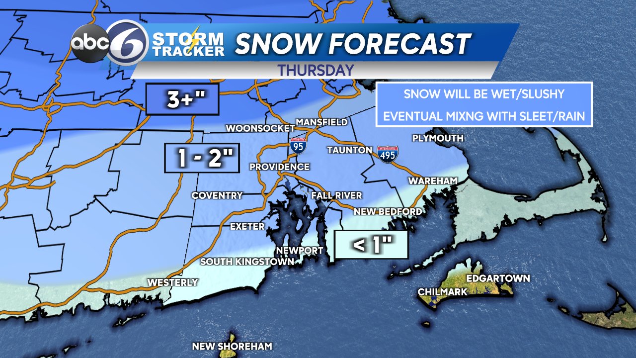
First, a messy mix on the way for tomorrow. Wet snow will begin shortly after sunrise, gradually changing over to sleet/rain from south to north. Chances of any freezing rain is low for our area.
A couple of slushy inches is expected for areas away from the coast, with much of it being washing away or diluted by the afternoon. Precipitation begins is likely to taper off by 3pm.
Quiet weather for Friday and most of Saturday, but Saturday night another messy storm comes in. Because the majority of the storm is nocturnal this time, we could see higher snow totals.
Right now, early estimates are for 2-4″ overnight between 11pm and dawn Sunday, also eventually mixing with sleet and rain from south to north. This could still change a bit so stay tuned.

Next week, the jet stream remains active and we will have colder air in place, so there will be a few more snow chances, and perhaps some bigger ones!
–Geoff