More gray weather ahead for Wednesday with rain to end the workweek
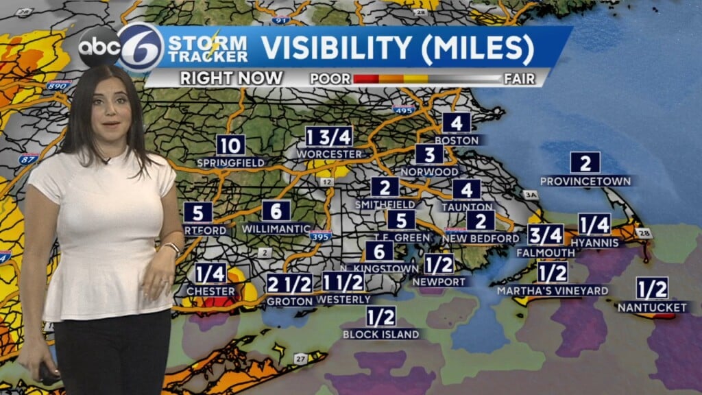
Expect patchy fog and drizzle tonight as we enter yet another overcast day on Wednesday. At least temperatures will be back into the 50s for a change, and less windy!
A slow-moving cold front will bring a line of moderate rain all day Thursday, with a few heavy pockets too. Right now the front looks to stall just east of our area, so while we may miss out on the worst of the rain, another 1-2″ is in the cards through the end of the week.
This will add to our already record rain surplus (10″) through the end of March. It will also throw our rivers back into minor flood stage.
Rain tapers off Friday morning, with maybe a nice sunset. Mostly sunny skies are expected Easter Weekend, with seasonable highs in the low-50s – but it will once again turn blustery.