Much Needed Rainfall Coming For Midweek
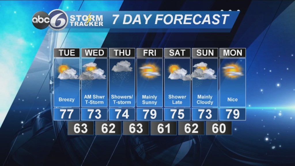
Tuesday starts off with sunshine in the morning, but some passing clouds will develop for the afternoon. Highs will be in the mid to upper 70s. You’ll notice the Southerly breeze picking up during the day ahead of an approaching frontal system from the west. Overnight scattered rain and isolated thunderstorms move into the area before daybreak Wednesday morning but the afternoon looks to dry a bit, although a leftover early afternoon shower is still possible. It will remain cloudy and cooler with highs in the low 70s.
Another round of scattered rain and thunder into Thursday but once again not a washout. Most of the rainfall looks to occur during the first half of the day. Expect mostly cloudy conditions with morning temperatures in the low 60s and afternoon highs in the mid 70s. We will begin to clear out overnight with lows in the upper 50s and low 60s.
Brighter and warmer on Friday with highs in the mid to upper 70s. Overnight will be clear with lows in the low 60s. The next threat of showers appears due in for Saturday evening and Sunday morning but its a little too soon to get the exact timing down on that right now.
Bill Gile
ABC6 Meteorologist