New Year’s Forecast
We were stuck with a lot of clouds today as the result of an inversion (temperatures actually getting warmer in the mid-levels of the atmosphere for a short distance) which created a ceiling of moisture in the form of those clouds. Those clouds are still left over and there is also a weak wave of energy coming in from the Great Lake tonight that will send more clouds our way that will endure into part of tomorrow.
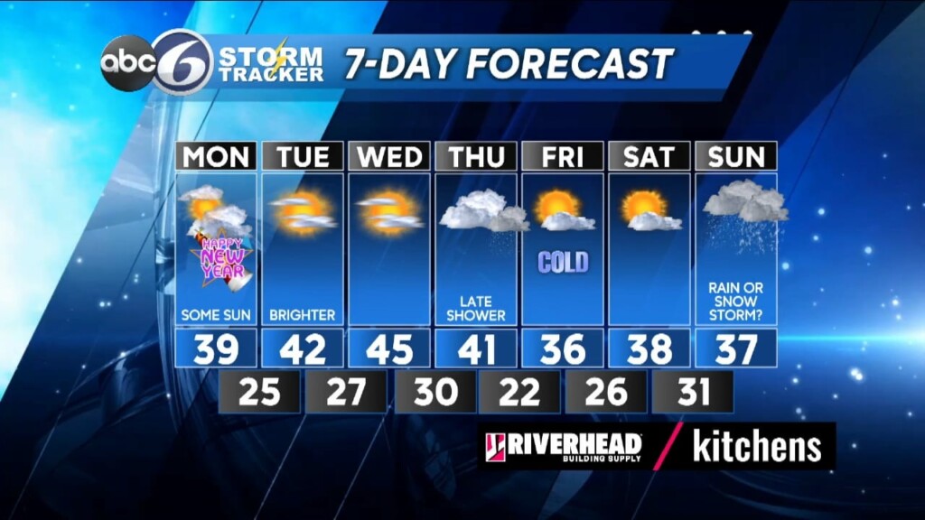
As we ring in the New Year at Midnight it’ll be cloudy and seasonable with temperatures near 33°. Look for lows overnight to be in the upper 20s to near 30°. Morning clouds will start New Year’s Day, but partial sunshine will return during the afternoon and highs will reach the upper 30s to near 40°.
A ridge of High pressure builds in for Tuesday and Wednesday bringing near normal highs in the lower 40s along with a fair amount of sunshine. A weak storm can bring a shower of rain late on Thursday that could potentially mix with some wet snowflakes Thursday night, but impacts from this system look to be very minor right now. However, Sunday could present us with a coastal storm and there will be cold air, either nearby or moving in, as it develops so we may be looking at a winter storm in RI. It’s obviously very early and plenty of time for things to change, but it’s worth giving you a heads up at this point!
ABC6 Meteorologist Bill Gile


