Much nicer weather arrives after tornadoes ripped across SE Mass Tuesday
A wild day across Southern New England – flash flooding and even tornadoes.
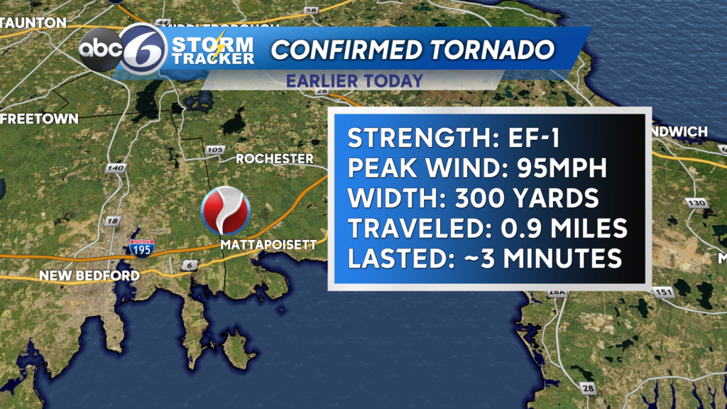
Let’s start with the latter. We had two tornado-warned storms move across SE Mass today, both that did produce confirmed tornadoes after National Weather Services damage assessment.

The first tornado formed right along the 195 corridor and brought down numerous trees, many falling on cars and homes in the Mattapoisett area.

Fortunately this was not the most populated area, but so many trees did pose extra hazardous to the homes that are in the area.

The second tornado formed out on the Cape in western portions of Barnstable and moved over Route 6 before moving into the Cape Cod Bay and disspiating.

We also picked up a month’s worth of rain in just a few hours, especially in SE Mass from the New Bedford area over to Falmouth and out onto the Cape.

Skies then cleared in the afternoon, but a few pop up showers formed and soaked parts of the area. Take a look below at one that approached the city from western Providence and Kent counties.

Skies will clear tonight and much better weather is on tap for Wednesday. Rain returns later on Thursday.
Have a great night!
–Meteorologist Geoff Bansen