Rain continues through much of Friday, very cold air arrives for the weekend
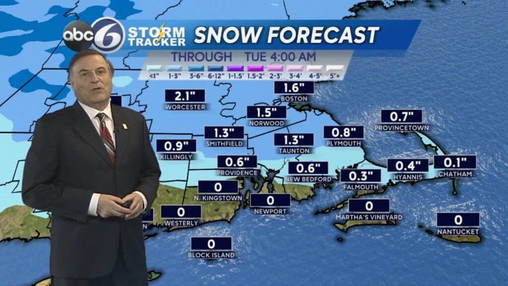
Showers have arrived here across the area, and mixed in are a some wet snowflakes from Providence on north over the next few hours.
Any mix will become all rain by early tomorrow morning. No accumulation or icing is expected due to above freezing temperatures at the surface.
Rain is possible all day long tomorrow, but it likely won’t be raining all day long – and the rain won’t also be that heavy. Amounts of around a quarter to a third of an inch of rainfall is expected.
All precipitation should end by the early in the evening. Highs tomorrow will be in the mid to upper 40s.
High pressure will return for the weekend, accompanied by colder and windy conditions. Highs will be back in the low-mid 30s Saturday, but gusty winds between 25-30MPH will make it feel like it is in the low-mid 20s. Wind chills Sunday morning will be down in the single digits!
Looking ahead to next week, mild air returns as we work up into the 50s. The end of February will be well above average, albeit a bit unsettled with some rain Wednesday into Thursday. The warm trends continue into the first week of March.