Still nice today, but wet weather coming for the weekend
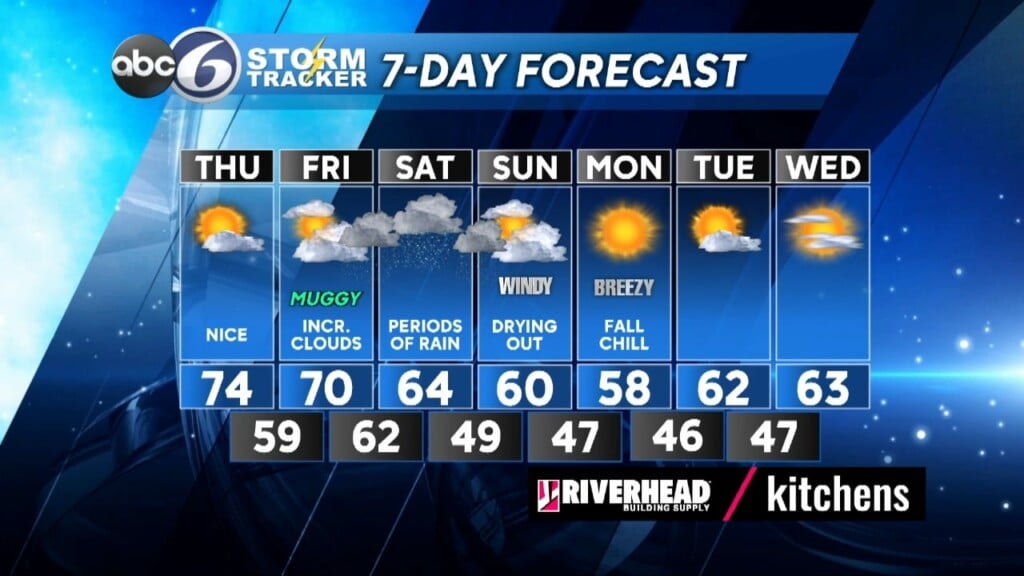
High pressure will provide us with another nice afternoon and mild temperatures as highs climb into the mid 70s. Low clouds and fog will return again tonight as lows only fall back to around 60°. Expect a mainly cloudy sky tomorrow as we watch a frontal boundary approach from the west and Tropical Storm Philippe works its way northward passing to the west of Bermuda. Highs will be near a muggy 70°. By Saturday southern New England will dealing with periods of rain coming from both these systems although the bulk of rain associated with the front coming in from the west will tend to stay in eastern NY and western New England while the rain from what will become a weakening post tropical storm looks at this point to just barely catch the east coast of MA. As a result we will be in between these 2 weather makers with lighter periods of rain for the most part. However, there is still time for adjustments to be made as a decaying tropical system tends to expand its area of rain outward so we could see some heavier bands working into RI on Saturday afternoon/evening. Winds also look to pick up and become rather gusty Saturday evening.
By Sunday there may be a left over shower or two early and then we can look for drying conditions to settle in with some breaks of afternoon sunshine, but it will remain on the windy side. Then we start the cool down into next week with highs in the upper 50s and low 60s as a good deal of sunshine returns.
ABC6 Meteorologist Bill Gile


