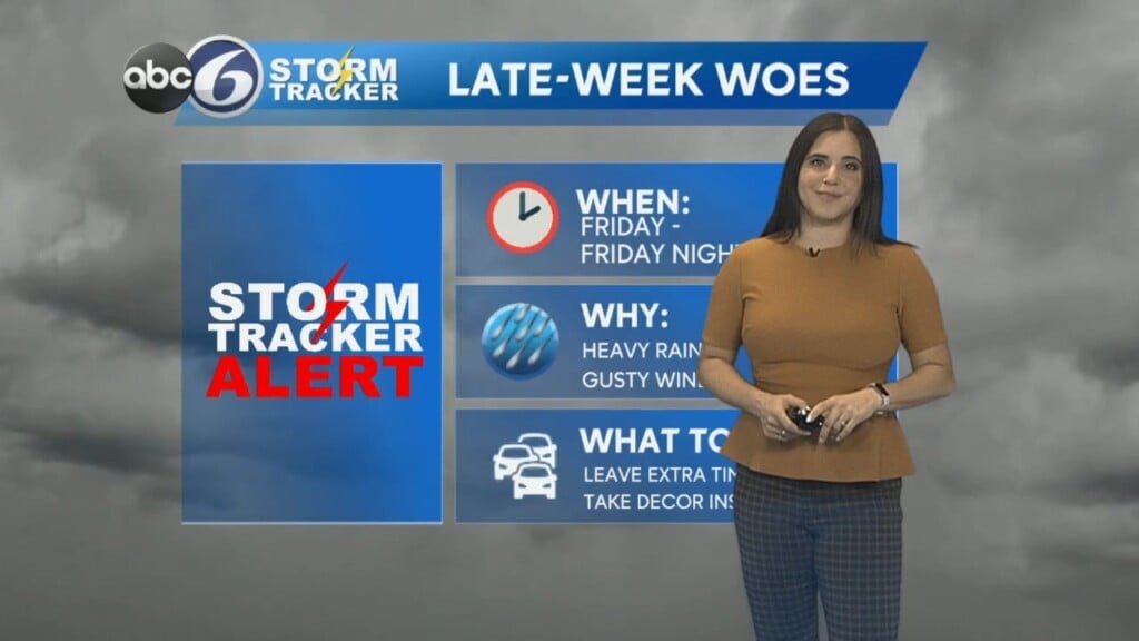
Stormtracker Alert Friday for wind and rain
We’ve already seen some rain across Southern New England, but both rain and wind will intensify later in the day.
We’ll see showers become more persistent and widespread over the course of the morning commute. The most uncomfortable conditions will be between roughly 10 AM and 2 PM. During this time, wind gusts and heavy rain will peak. Gusts could get up to 60 mph for the coast, leading to High Wind Warnings for the entire coastlines of Rhode Island and Massachusetts. Gusts inland could peak near 50 mph, leading to Wind Advisories in those areas as well.
Highs will be in the mid to upper 50s– quite warm for this time of year. However, as this storm leaves in the late afternoon, colder air rushes in behind it. This may lead to a lingering shower, or even light wintry mix after sunset, but precipitation winds down later at night. That said, temperatures plummet overnight as well, which could lead to any leftover wet spots freezing and becoming icy by morning. Be vigilant if you have to hit the road early on Saturday!
The rest of Saturday is pretty decent. We’ll have a mix of sun & clouds and highs around 40 (pretty close to average for this time of year). It’ll still be breezy, but nothing even close to Friday’s wind.
Sunday we’re keeping an eye on a quick disturbance that could increase clouds for a time. It’ll be breezy as well with gusts in the 20s. Highs will be in the mid 40s. By the way, the Winter Solstice is on Sunday, meaning the beginning of astronomical winter!
However, as that disturbance leaves, more cold air funnels in and temperatures plummet yet again by Monday. It seems like Mother Nature is eager to celebrate winter’s arrival, as highs will only be in the low 30s despite the sun.
— Kristina