Sunday storm still on track
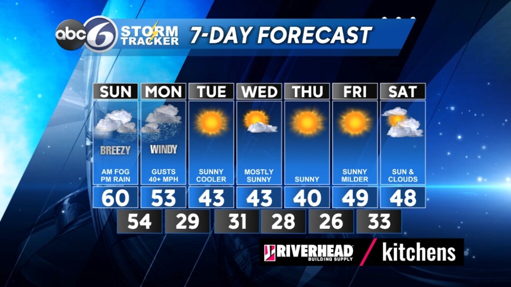
PROVIDENCE, R.I. (WLNE) — Rain showers are happening this afternoon and winds will gradually increase, but the Sunday’s storm is still on track for tonight. It is a multi-faceted storm with three main parts: Rain, Wind, and Coastal impact. The Monday morning commute could be complicated with the aftermath of the storm.
Timing has rain and wind developing the second half of Sunday, peaking overnight in intensity, and ending Monday morning.
Rainfall will be heaviest around 4 a.m. Monday and will include thunderstorm downpours. The result is the potential of inches of rainfall. Final rainfall totals will likely be in the one to three inch range. Wet basements and the potential of localized flooding is likely. Action: clean leaf litter from drains and make sure sump pumps are in good working order should your basement indeed take on water.
Extremely gusty winds will impact primarily coastal regions with gusts peaking near 60 mph. Otherwise, we are expecting maximum winds with gusts near 50 mph. As a result, power outages are likely, weaker trees and tree limbs are vulnerable, and unsecured objects will likely be lifted. Action: Secure Santa and all your holiday decorations or bring them inside. Charge up your phone and chargeable batteries.
Coastal concerns with this storm are high with this storm. Wave heights along the coast are expected of seven to 12 feet, and up to 20 feet offshore. Coastal flooding will be likely but classified as minor flooding at less than a foot deep. Expect wet basements in coastal homes.
Monday morning we will see the storm pull away and we should increase the sunshine and winds will relax through the afternoon. The remainder of the week looks bright and dry with cooler and more seasonable highs in the 40s.