Winter Storm Watch: Waking up to snow on Super Bowl Sunday
Good morning! A sunny start today, but clouds will barge in this afternoon and skies will turn overcast by this evening.
Dinner plans should be fine this evening, as snow is expected to hold off until 9-10 p.m.

Snow will turn heavy for several hours during the middle of the night, approximately midnight until 3-4 a.m.
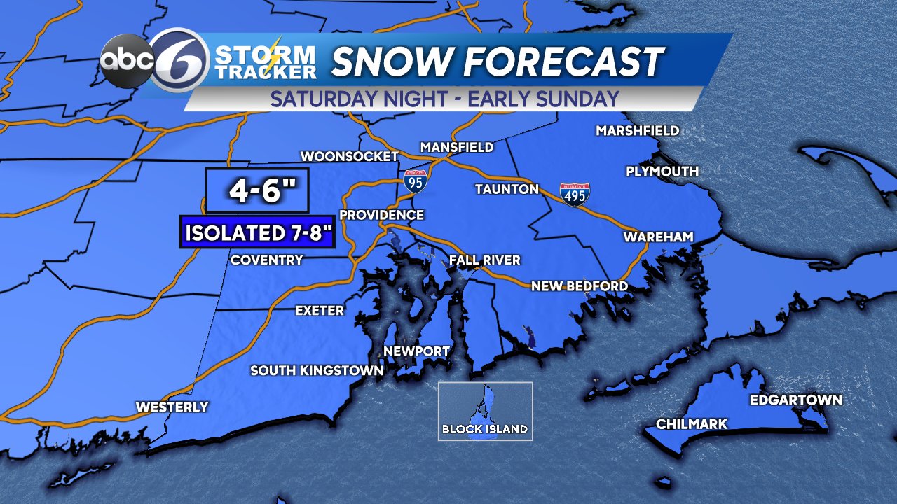
The majority of our area will be around 6″ of snow, but we are allowing for as little as 4″ closer to the shore, as well as some isolated spots approaching 8″ due to unpredictable snow banding.
Travel should be avoided early Sunday, but the roads will likely be much improved by the afternoon, especially main roads.
Because this is not a coastal storm, treacherous travel is really the only impact with this storm. No wind-related power issues are expected.
The active pattern continues, and we then have three more storms lined up for next week! As of right now:
- Tuesday Night – All snow, but storm has trended a bit further south, which would limit snow output.
- Thursday – Snow to sleet/rain.
- Next weekend – Too soon to tell, but the potential is there for a sizeable storm.
Be safe out there, but enjoy the snow (and the Super Bowl!)


