Weather Alert: Major winter storm to hit Sunday
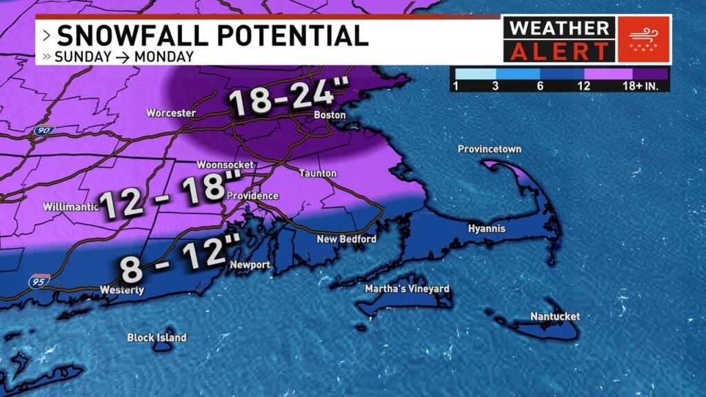
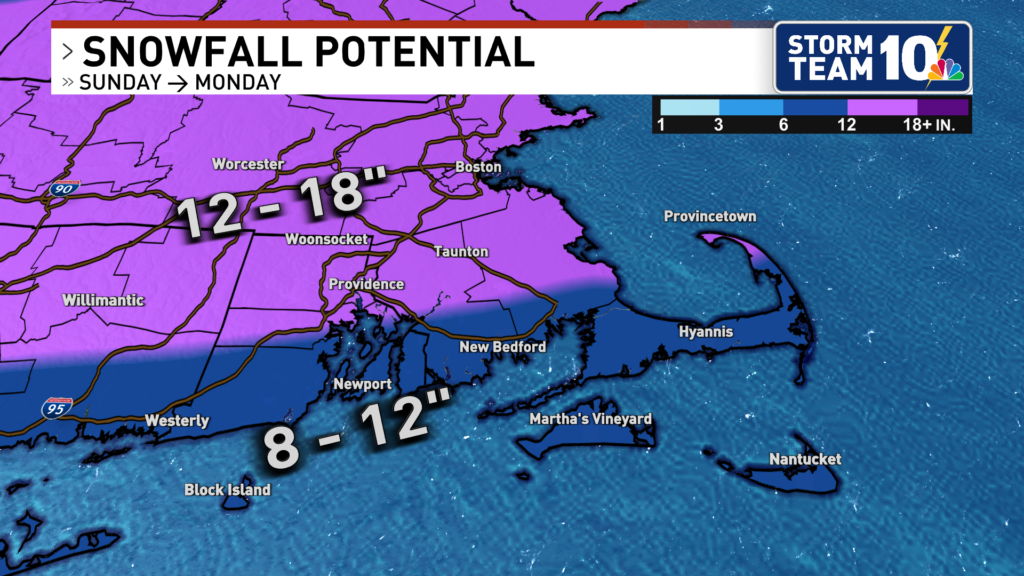
A Storm Team 10 Weather Alert is in effect as significant snowfall amounts are expected across Southern New England. It all starts on Sunday when snow develops from southwest to northeast between 8 AM and 11AM. Snow quickly intensifies, with the potential of 2 inches per hour starting after 1 PM. Sleet could mix in at the south coast around 6-9 PM. At this point, there is likely 8-14″ of snow on the ground. Heavy snow continues for interior locations, with the final tally close to 14-20″ across most of Providence County and northern Bristol County in Massachusetts. The worst of the storm is over by midnight, but scattered light snow showers continue into Monday. High-resolution models are hinting at the potential for wrap-around snow showers and mesoscale band features to develop mid-morning Monday, enhancing snow coverage across Southern New England. Some additional snowfall is possible before this storm departs Monday evening.
After the snow ends, the cold remains for the workweek. High temperatures each day this week will only reach the low to mid-20s, with overnight lows in the single digits each night. The extended forecast looks mainly dry with no additional snow chances until at least next weekend.