Wednesday will be a lot like today
FROM ABC6 Meteorologist Bill Gile
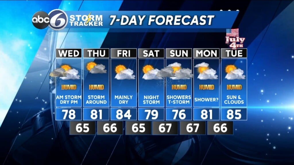
We are still stuck in a nearly blocked weather pattern and it really doesn’t look to begin to change significantly until after the Fourth of July. It will remain fairly quiet for most of the night tonight with just a shower around. However, tomorrow looks to be a lot like today where we start the early morning off some locally heavy showers and thunderstorms. Those shower will begin to depart before noon with breaks of sun developing for the afternoon (more so than what we saw today).


A nice breeze will prevail out from the south as well at 7-15 mph.

Keep an eye to the sky for tomorrow evening though as another round of showers and scattered T-storms come in from the west.
By Thursday, we’ll see a little more sunshine, but there will still be a shower or thunderstorm around in this muggy air mass. As we head into Friday and the start of the Fourth of July weekend it will become less humid and looks to stay on the day side without the threat of showers or storms. That will change by Saturday night and Sunday as higher humidity returns along with showers and storms likely.
Monday should be a mainly dry day, but I can’t completely rule out a shower threat. Then the Fourth is looking like a nice summer day with a mix of sun and clouds as highs climb well into the 80s.


