Weekend warm up
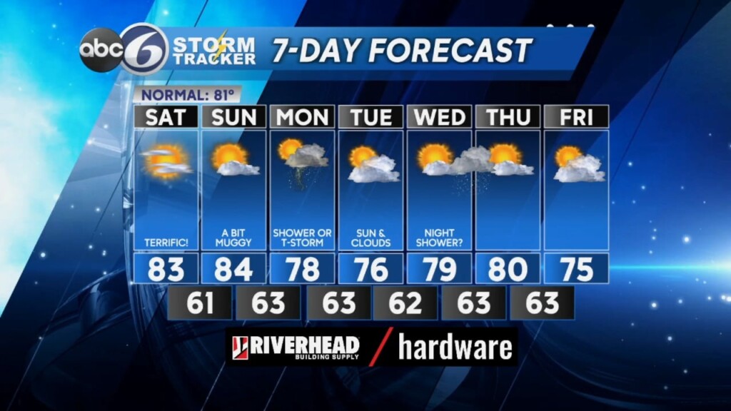
Following a beautiful Friday afternoon thanks to an area of High pressure to our southwest, we’ll be looking at a very pleasant evening and it won’t be as cool overnight under a mainly clear sky. Lows will drop to the low 60s.
We will continue to enjoy beautiful weather through the weekend as High pressure remains in control as it passes south of New England Saturday and then centers itself off the Northeast coast Sunday. This means plenty of sunshine Saturday and still comfortable levels of humidity. Sunday will see an increase in humidity and some afternoon clouds. Regardless, both days look good for getting outdoors with highs in the low and mid 80s.
A weak upper-level disturbance descending from Southeastern Canada on Monday will bring increasing clouds with some spot showers or thundershowers, especially later in the day and Monday night. Tuesday and Wednesday, we will see clouds build up during the afternoon that can produce an isolated shower or sprinkle. Otherwise, conditions look dry through the middle of the week.
ABC6 Meteorologist Bill Gile


