Wet and Windy Tonight, Drying Monday
Low pressure moving up from the south will be tracking northward passing just to the west of Rhode Island overnight. Some of the heaviest rainfall will occur between Midnight and 3AM and that’s also when some of the strongest winds will be realized as well, gutsing 25-35mph at times from the SE. In addition to the rain, temperatures will be rising overnight into the low 50s.
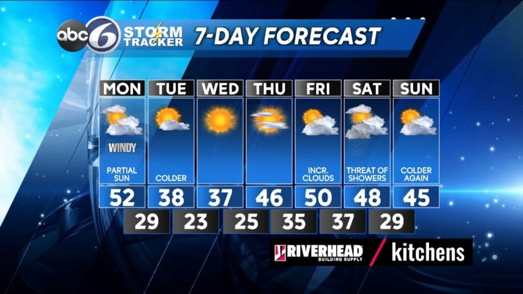
All of the rain will be gone by daybreak so as you head off to the bus stop or get ready for work it’ll just be mainly cloudy and windy. Temperatures will still be in the low 50s for the morning hours, but will start to cool back into the 40s during the afternoon. Winds will be out of the west at 12-25 MPH. As colder air works in look for more clouds and a threat for a spot shower or sprinkle in the early afternoon and then the sky will clear out Monday night.
Tuesday and Wednesday will feature some very cold air with highs only in the upper 30s, but the wind will be much lighter as High pressure build into the region. As the High moves offshore the second half of the week will stay dry and there will be a moderation of temperatures getting back to near normal, reaching into the upper 40s to near 50°.
ABC6 Meteorologist Bill Gile


