Winter Returns
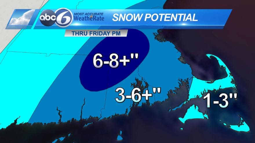
A Winter Storm Warning is in effect for most of Rhode Island and SE MA, excluding the Cape where a Winter Weather Advisory is in effect. What this means is that we are going to continue to see a heavy, wet snow accumulating this morning. The commute will be very messy with the wet snow and limited visibility thanks to the snow falling at a fast rate. Most of the area will pick up 3-6" of snow, the higher totals will be to the north and west, the lesser amounts will be towards the coastline. Some areas in NW Rhode Island are already reporting 6" of snow, areas to the north and west will likely see higher amounts by the time this system winds down this afternoon. Even lower totals can be expected for far southeast MA where the rain sticks around a bit longer. *I’ve updated the snow total map to include those higher totals for northern areas.* Winds are currently gusting to near 30MPH. With the heavy wet snow, some downed tree limbs are possible as well as power lines.
Snow starts to wind down by mid-afternoon from west to east. We actually end up with really clear conditions overnight but that will allow temperatures to drop quickly. Overnight lows will be down into the upper teens to low 20s so anything untreated will be very slippery.
ABC6 Meteorologist Chelsea Priest