Worst of the storm passes, still some Monday snow
Overnight into early Monday, the worst of this storm will shift away, although occasional light snow and snow showers may continue in some areas through sunrise.
The strongest wind gusts will accompany the heaviest precipitation and move to the east as well into Monday morning.
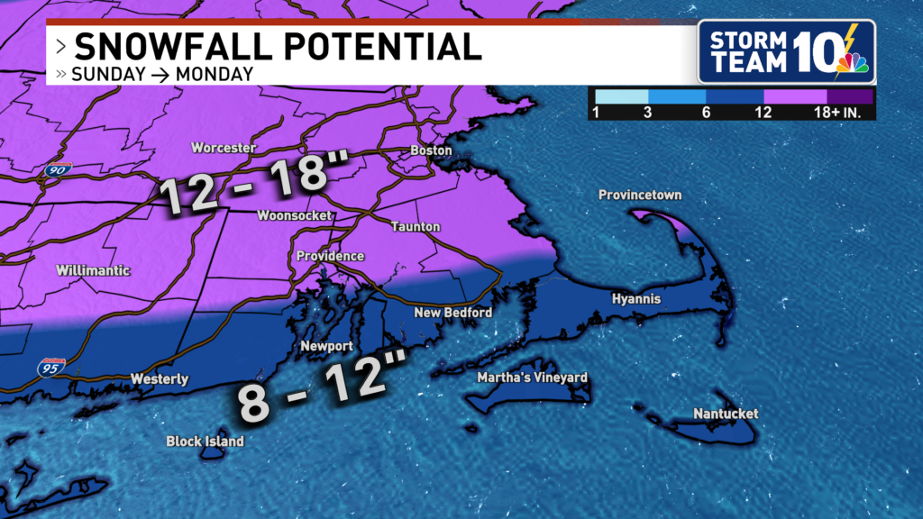
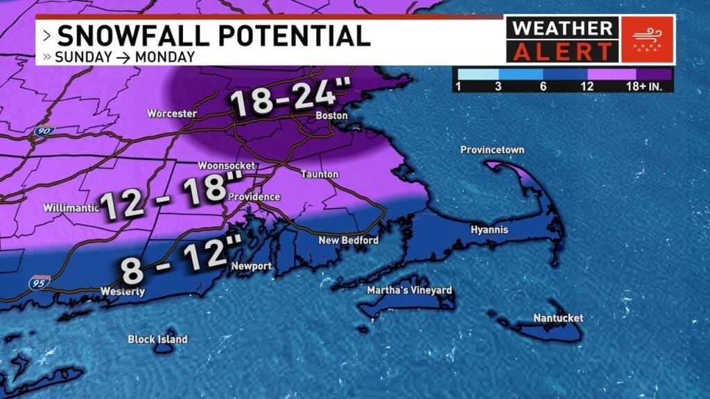
The storm performed just about as we expected, bringing a 10-14″ total to the southern parts of the area, 14-18″ for areas farther inland.
And we still will have additional snow and snow showers through Monday, which will add the potential of 1-4″ more for some (especially eastern Massachusetts).
The overall weather pattern supports a sustained cold, dry pattern for the upcoming week, with high temperatures staying below freezing and overnight lows in the single digits for many of us through Friday!